Full Description
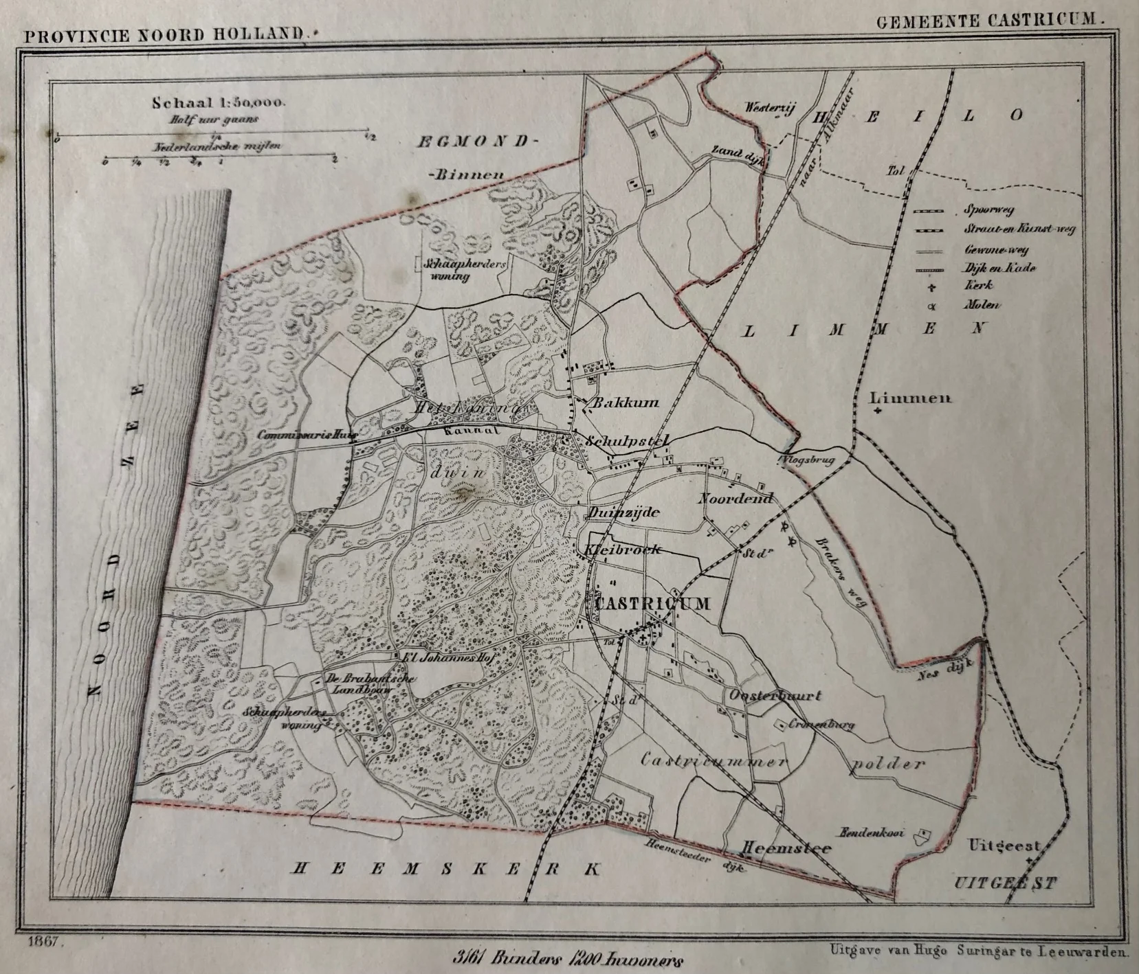
This antique map is titled “Provincie Noord-Holland – Gemeente Castricum.” It shows a detailed view of the municipality of Castricum in North Holland. The map includes nearby areas such as Bakkum, Schulpstel, and Kleibroek. Roads, plots, and boundaries appear clearly defined.
H. J. Kuijper designed this map, and Hugo Suringar published it in 1867. The lithographic technique gives the map a clean and precise appearance. As a result, it provides both historical and geographic insight into the Castricum region.
The map measures 15 × 18.5 cm and is in good condition. Small foxing spots are visible, as shown in the scan. Collectors value this antique map of Castricum for its local detail and clear presentation.
VAT: Margin goods, no VAT charged.
About the Artist: Jacob Kuijper
J. Kuijper, also known as Jacob Kuijper (1821–1908), was a Dutch cartographer and geographer. He specialized in producing detailed maps of the Netherlands and its overseas territories during the 19th century. Kuijper co-founded the Royal Dutch Geographical Society and published important atlases aiding navigation and geographic knowledge. His maps gained recognition for their accuracy and fine detail. Collectors appreciate his cartographic works for their historical and technical value.
About the Era: 19th Century (1800s)
The 19th century marked the era of cartography, as mapmaking became professional, organized, and global. Scientists and surveyors used improved instruments and statistical methods, turning maps into trusted scientific documents with greater precision. Surveying advanced with triangulation, precise tools, and national topographic programs. Printing technology improved, adopting lithography and early color printing to produce clearer, richer maps. New thematic maps used techniques like choropleth, flow lines, and dot density to show data visually. Notably, Charles Minard pioneered multivariate mapping, combining multiple data themes on one map.
Map design reflected industrial and Victorian tastes, balancing detail and readability. Governments supported mapping societies to control territories at home and abroad. Maps became essential for urban planning, empire-building, and scientific research. The 19th century also fostered a global map culture, sharing knowledge internationally. Today, 19th-century maps are prized for their science and artistry. They laid the foundation for modern cartography, data visualization, and geographic information science, and are celebrated by collectors and institutions for their insight into industrial-age geography and culture.