Full Description
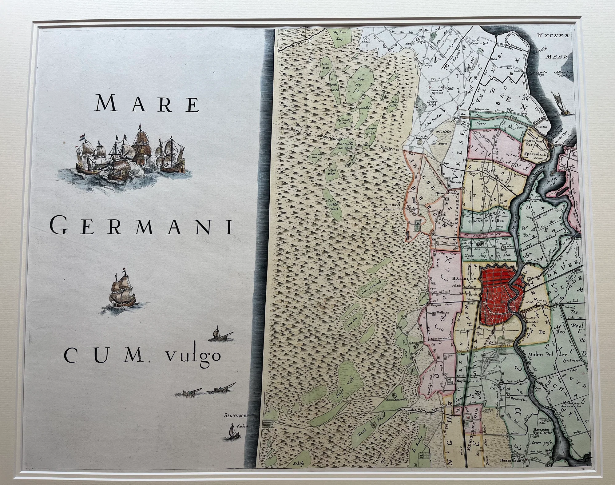
This detailed antique Haarlem region map shows the area around Haarlem. Johannes Dou and Steven van Broeckhuysen created it for the 1746 edition of the Hoogheemraadschap van Rijnland atlas. Melchior Bolstra revised the atlas.
The map highlights coastal and inland waterways. It marks towns like Haarlem, Heemstede, Spaarndam, and Zandvoort, which was a small fishing village at the time.
This antique Haarlem region map is important because it shows the early Dutch water management system. The Rijn estuary had silted up, making water control vital. The Spaarne River plays a key role in this system.
Johannes Dou and Steven van Broeckhuysen combined detailed mapping with practical knowledge of water management. Their work helps us understand how the Dutch controlled and used their waterways in the 18th century.
Discover all our Antique Dutch Maps and grow your collection.
About the Artist: Johannes Dou, Steven van Broeckhuysen
Johannes Dou (1615–1682), also known as Jan Jansz. Dou or Jan Janszoon Douw, was a Dutch land surveyor and cartographer primarily active in the mid-17th century. Born in Leiden, he studied at the University of Leiden and was admitted as a land surveyor by the High Court of Holland in 1635.
Dou is noted for his work on detailed maps, especially for water management and regional topography, working for organizations such as the Hoogheemraadschap (regional water boards). His contributions were important for Dutch cartography, particularly in managing the complex waterways of the Netherlands.
About the Era: 18th Century (1700s)
During the 18th century, mapmaking became more scientific and precise. Improved instruments like the telescope and chronometer helped cartographers increase accuracy, shifting maps from decorative art to factual documents. Copperplate engraving stayed as the main printing method, producing fine lines, while hand-coloring added visual impact. French cartographers, such as the Cassini family, led national surveys with geodetic measurements and triangulation, while Dutch mapmakers like Joan Blaeu enhanced printing and atlas quality, ushering in a golden age of atlases.
Maps began including more information and notes to help users, and ornate decorations mostly gave way to scientific clarity, except for cartouches and borders. National and colonial ambitions guided map production to aid navigation and territorial claims. By the late 18th century, large-scale surveys set modern cartography standards. Today, 18th-century maps mix scientific knowledge with artistry, are prized by collectors, and have influenced later cartographic methods. They offer insights into Enlightenment exploration and geography.