Full Description
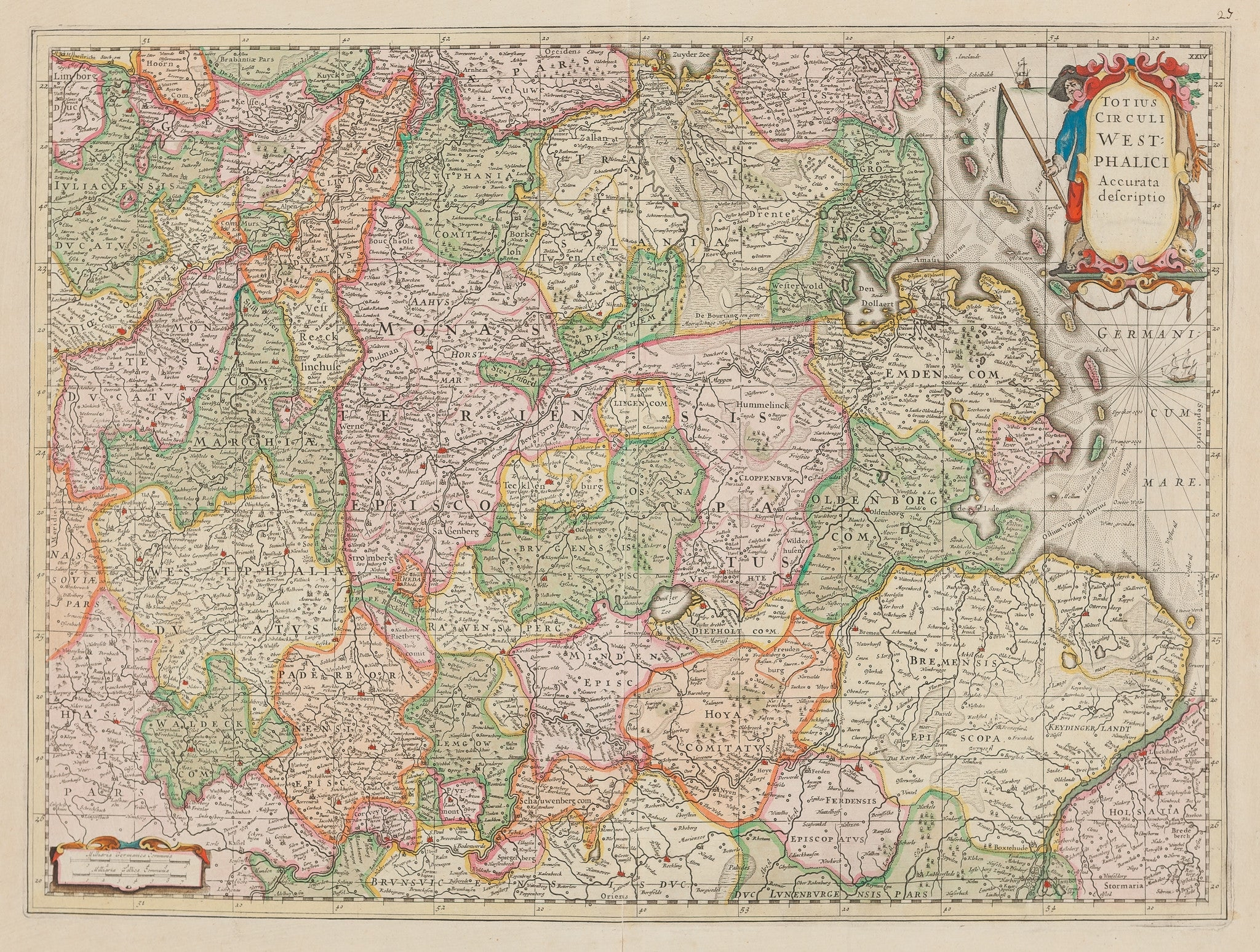
Totius Circuli West Phalici Accurata Descriptio is a fine handcoloured map of Westphalia, published by Henricus Hondius in 1639. The engraving shows the region of Westphalia and surrounding areas, including Hamburg, Cologne, Groningen, and Münster. The composition combines geographic accuracy with elaborate cartouches and decorative flourishes typical of 17th-century Dutch mapmaking.
This antique map of Westphalia measures 40 x 54 cm and is in very good condition, with minor weakness at the end of the middle fold. The colouring is vivid and enhances the detailed engraving. Collectors value this antique map of Westphalia for its artistry, historical insight, and quality typical of Hondius’ celebrated work. VAT: Margingoods, no VAT.
Make sure to explore all our City views and antique map collection at our store located in the historic heart of Haarlem.
About the Artist: Henricus Hondius
Unfortunately, there is no information available about this artist yet. We will update this section when possible.
About the Era: 17th Century (1600s)
The 17th century greatly advanced mapmaking and printmaking, with copperplate engraving enabling cartographers to create detailed and accurate maps. During the Dutch Golden Age, increased trade and exploration boosted the demand for maps, turning map printing into a major industry. Skilled engravers carved designs into copper plates, applied ink, and pressed paper to produce fine prints. After printing, artisans hand-colored maps to enhance their beauty and clarity. Copperplate printing replaced woodcuts, offering smoother lines and finer details. Renowned mapmakers like Blaeu, Janssonius, and Hondius combined scientific knowledge with artistic skill. This era produced remarkable atlases, such as Joan Blaeu’s Atlas Maior. Maps not only charted geography but reflected political power, trade routes, and scientific discoveries. Printed maps became essential for navigation, colonization, and education. Dutch publishers led Europe’s map market, shaping global cartographic standards. These original maps remain prized for their detail and artistry, influencing future mapmaking and holding high value for collectors and museums today.