Full Description
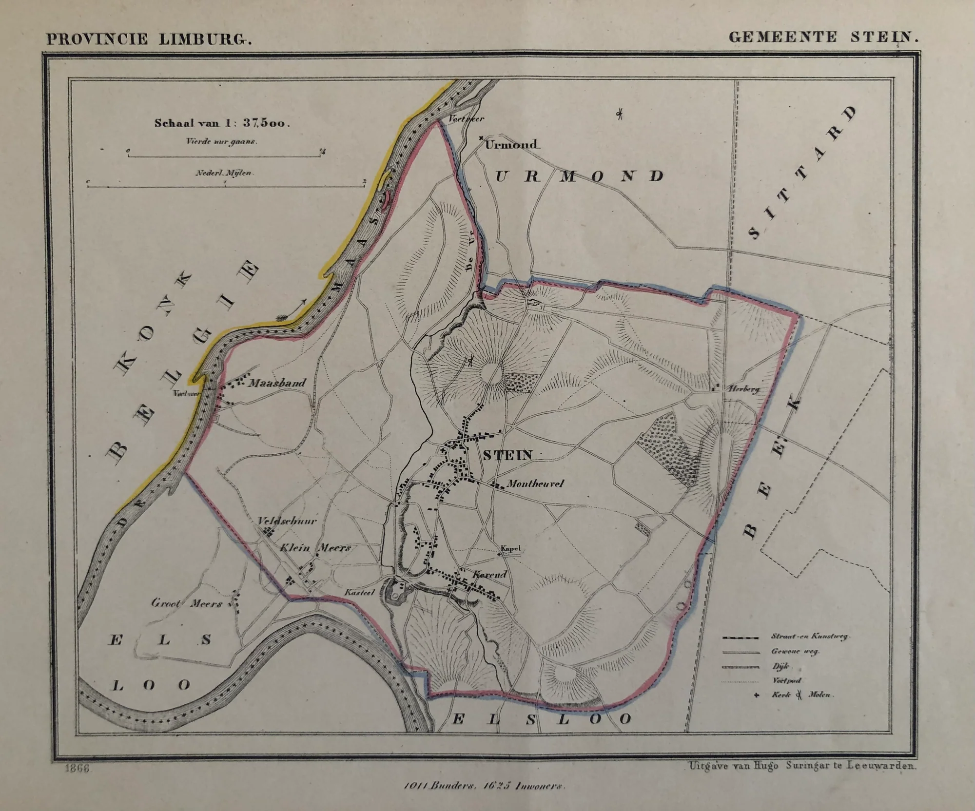
This vintage Stein map shows the detailed layout of the Stein municipality in Limburg province. J. Kuyper drew it, and Hugo Suringar published it in 1866 as part of the famous Gemeenteatlas van Nederland series. The hand-colored lithograph measures 15 by 19 cm. It remains in very good condition with minimal age-toning.
Kuyper created precise maps of all Dutch municipalities between 1865-1870, making this a key historical document. Collectors value these small-scale maps for their accuracy and colorful borders. Own this vintage Stein map to display authentic 19th-century Dutch cartography from Limburg.
Discover all our Dutch antique maps in our store located in the historic heart of Haarlem.
About the Artist: Jacob Kuijper
J. Kuijper, also known as Jacob Kuijper (1821–1908), was a Dutch cartographer and geographer. He specialized in producing detailed maps of the Netherlands and its overseas territories during the 19th century. Kuijper co-founded the Royal Dutch Geographical Society and published important atlases aiding navigation and geographic knowledge. His maps gained recognition for their accuracy and fine detail. Collectors appreciate his cartographic works for their historical and technical value.
About the Era: 19th Century (1800s)
The 19th century marked the era of cartography, as mapmaking became professional, organized, and global. Scientists and surveyors used improved instruments and statistical methods, turning maps into trusted scientific documents with greater precision. Surveying advanced with triangulation, precise tools, and national topographic programs. Printing technology improved, adopting lithography and early color printing to produce clearer, richer maps. New thematic maps used techniques like choropleth, flow lines, and dot density to show data visually. Notably, Charles Minard pioneered multivariate mapping, combining multiple data themes on one map.
Map design reflected industrial and Victorian tastes, balancing detail and readability. Governments supported mapping societies to control territories at home and abroad. Maps became essential for urban planning, empire-building, and scientific research. The 19th century also fostered a global map culture, sharing knowledge internationally. Today, 19th-century maps are prized for their science and artistry. They laid the foundation for modern cartography, data visualization, and geographic information science, and are celebrated by collectors and institutions for their insight into industrial-age geography and culture.