Full Description
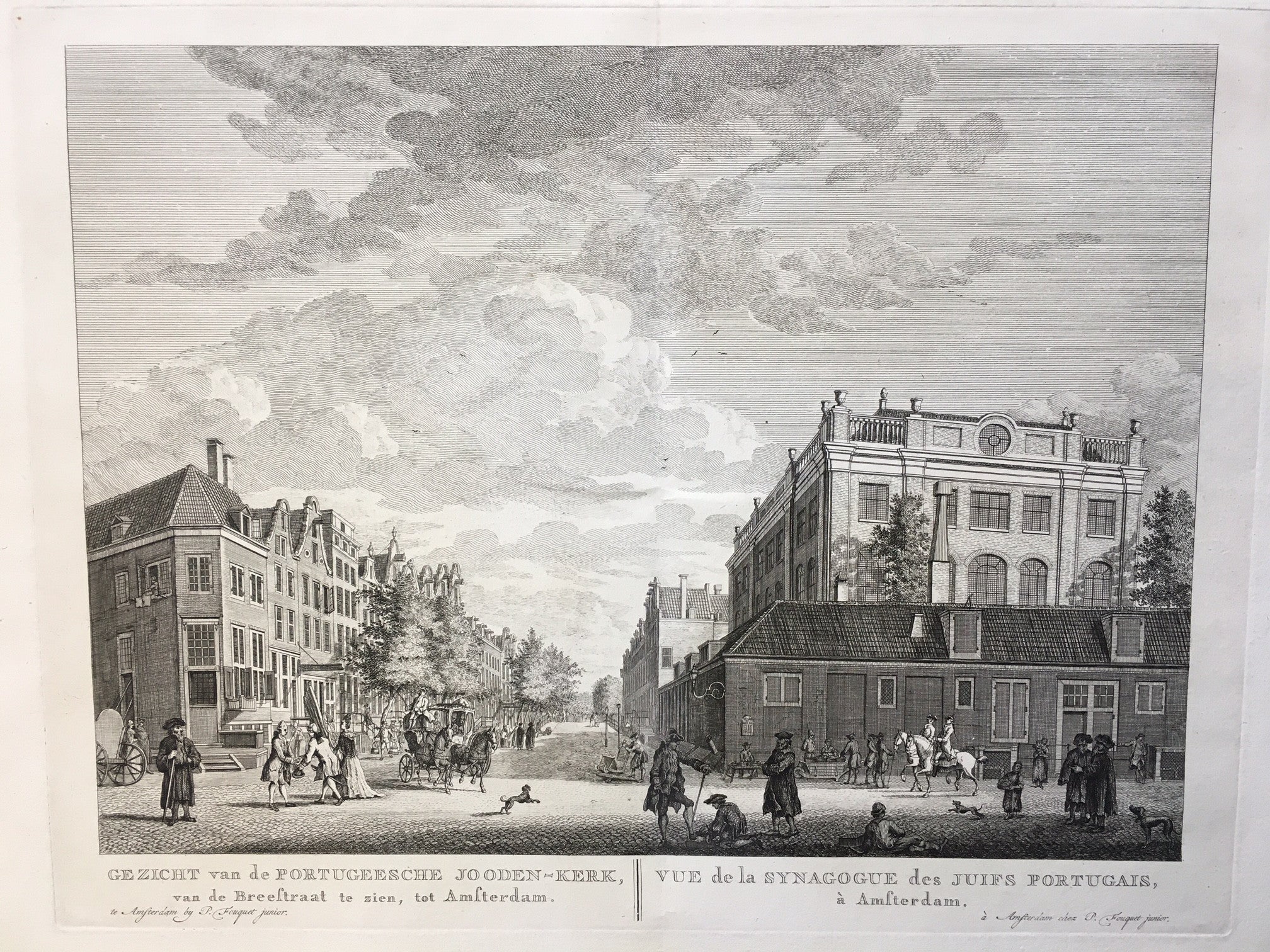
Gezicht van de Portugeesche Jooden‑Kerk is a beautiful engraving by Pieter Fouquet Junior after Jan Schouten. Created around 1775, it shows the famous Portuguese Synagogue in Amsterdam, located on Mr. Visserplein. The scene captures the grandeur of the synagogue and its surroundings with refined architectural detail and lively city atmosphere. Fouquet’s engraving reflects both artistic precision and documentary value, offering a timeless view of Amsterdam’s Sephardic heritage.
This Portuguese Synagogue Amsterdam engraving measures 28.5 x 37.5 cm and remains in very good condition. The impression is strong, and the lines retain their clarity. Collectors appreciate this Portuguese Synagogue Amsterdam engraving for its elegance, historical depth, and fine craftsmanship. VAT: Margingoods (No VAT).
Explore our entire collection of City Views, antique maps, Botanical prints and much more at our store located in the historic heart of Haarlem.
About the Artist: Pieter Fouquet Junior
Unfortunately, there is no information available about this artist yet. We will update this section when possible.
About the Era: 18th Century (1700s)
During the 18th century, mapmaking became more scientific and precise. Improved instruments like the telescope and chronometer helped cartographers increase accuracy, shifting maps from decorative art to factual documents. Copperplate engraving stayed as the main printing method, producing fine lines, while hand-coloring added visual impact. French cartographers, such as the Cassini family, led national surveys with geodetic measurements and triangulation, while Dutch mapmakers like Joan Blaeu enhanced printing and atlas quality, ushering in a golden age of atlases.
Maps began including more information and notes to help users, and ornate decorations mostly gave way to scientific clarity, except for cartouches and borders. National and colonial ambitions guided map production to aid navigation and territorial claims. By the late 18th century, large-scale surveys set modern cartography standards. Today, 18th-century maps mix scientific knowledge with artistry, are prized by collectors, and have influenced later cartographic methods. They offer insights into Enlightenment exploration and geography.