


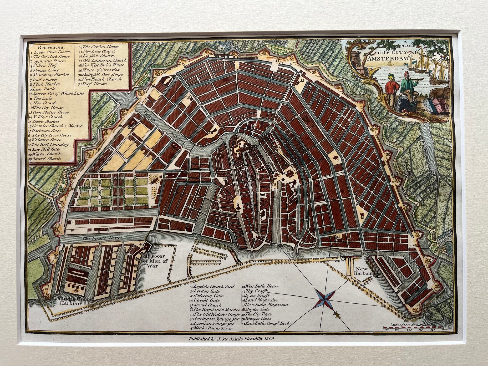
A Plan of the City of Amsterdam is a detailed hand-coloured map engraved by Thomas Hay and published by J. Stockdale in 1800. The map clearly shows canals, harbours, docks, and the fortified shape of old Amsterdam. Small ships fill the harbour, reminding viewers of the city’s past as a major trading hub. Each line reflects careful craftsmanship and precise design from the early 19th century.
This map of Amsterdam 1800 measures 18 x 25.5 cm and is in very good condition. The handcolouring remains bright, and the engraving still looks clean and crisp. Collectors prize this map of Amsterdam 1800 for its fine detail, compact format, and insight into the city’s maritime history. VAT: Margingoods.
Explore our entire collection of City Views, antique maps, Botanical prints and much more at our store located in the historic heart of Haarlem.


