Full Description
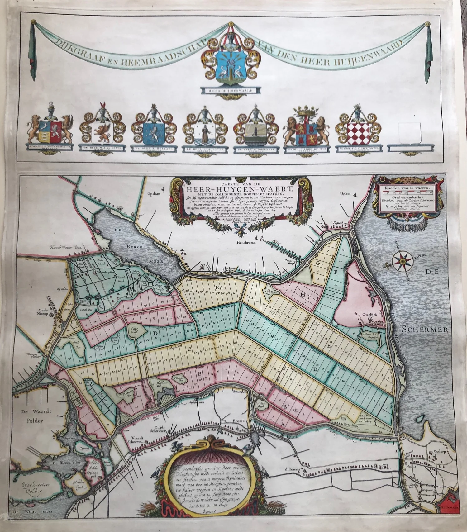
This Heerhugowaard Antique Map titled ‘Caerte van de Heer-Huygen-Waert’ is an impressive engraved map depicting one of the major 17th‑century Dutch land reclamation projects. Between 1540 and 1650 this area northeast of Alkmaar was successfully drained, with the final work completed in 1621 after authorization from the States of Holland and West‑Friesland. The map by Nicolaas Jansz. Visscher shows the newly reclaimed land divided into lots of fifteen morgen, a traditional Dutch land measure.
The engraving measures 56 x 56 cm and is handcoloured later, likely in the 19th century. Strong lines and subtle colouring reveal fields, dikes, and waterways with remarkable precision. The design reflects both practical mapping skill and aesthetic harmony typical of early Dutch cartography.
This Heerhugowaard Antique Map is a fascinating historical document for collectors and enthusiasts of Dutch polder landscapes. It celebrates the engineering achievement of land reclamation and the artistic quality of Visscher’s detailed work.
About the Artist: Nicolaes Visscher
Nicolaes Visscher I (1618–1679) was a Dutch engraver, cartographer, and publisher from Amsterdam. He continued his father Claes Janszoon Visscher’s mapmaking tradition during the Dutch Golden Age. Visscher created highly decorative world maps, regional atlases, and city views with elaborate borders. His famous works include the 1658 double-hemisphere world map featuring mythological scenes. Collectors value his maps for their artistry, accuracy, and historical significance.
About the Era: 19th Century (1800s)
The 19th century marked the era of cartography, as mapmaking became professional, organized, and global. Scientists and surveyors used improved instruments and statistical methods, turning maps into trusted scientific documents with greater precision. Surveying advanced with triangulation, precise tools, and national topographic programs. Printing technology improved, adopting lithography and early color printing to produce clearer, richer maps. New thematic maps used techniques like choropleth, flow lines, and dot density to show data visually. Notably, Charles Minard pioneered multivariate mapping, combining multiple data themes on one map.
Map design reflected industrial and Victorian tastes, balancing detail and readability. Governments supported mapping societies to control territories at home and abroad. Maps became essential for urban planning, empire-building, and scientific research. The 19th century also fostered a global map culture, sharing knowledge internationally. Today, 19th-century maps are prized for their science and artistry. They laid the foundation for modern cartography, data visualization, and geographic information science, and are celebrated by collectors and institutions for their insight into industrial-age geography and culture.