Full Description
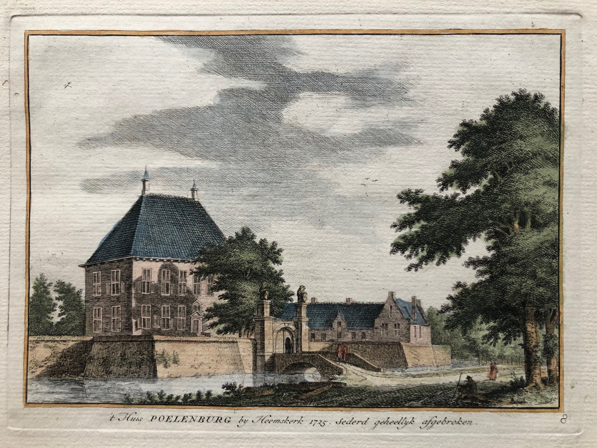
This Huis Poelenburg Heemskerk Print is titled “’t Huis Poelenburg by Heemskerk 1725, sederd geheellyk afgebroken.” It shows the former mansion Huis Poelenburg near Heemskerk in Kennemerland. The print records a building that no longer exists, which adds to its historical value.
Hendrik Spilman created this hand-coloured etching as part of his series Kennemerlandsche Gezichten. This example is number 8 from the series, which was published in 1739. The composition is clear and decorative, with careful attention to landscape and architectural detail.
The Huis Poelenburg Heemskerk Print measures 13.5 × 19.5 cm and is in very good condition. Collectors value this antique print of Huis Poelenburg for its rarity, fine etching, and documentation of lost Dutch heritage.
VAT: Margin goods, no VAT charged.
About the Artist: Hendrik Spilman
Unfortunately, there is no information available about this artist yet. We will update this section when possible.
About the Era: 18th Century (1700s)
During the 18th century, mapmaking became more scientific and precise. Improved instruments like the telescope and chronometer helped cartographers increase accuracy, shifting maps from decorative art to factual documents. Copperplate engraving stayed as the main printing method, producing fine lines, while hand-coloring added visual impact. French cartographers, such as the Cassini family, led national surveys with geodetic measurements and triangulation, while Dutch mapmakers like Joan Blaeu enhanced printing and atlas quality, ushering in a golden age of atlases.
Maps began including more information and notes to help users, and ornate decorations mostly gave way to scientific clarity, except for cartouches and borders. National and colonial ambitions guided map production to aid navigation and territorial claims. By the late 18th century, large-scale surveys set modern cartography standards. Today, 18th-century maps mix scientific knowledge with artistry, are prized by collectors, and have influenced later cartographic methods. They offer insights into Enlightenment exploration and geography.