Full Description
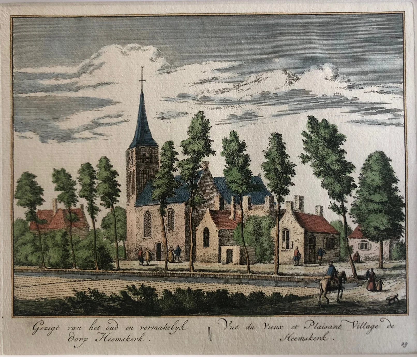
This antique Heemskerk village view is titled “Gezigt van het oud en vermakelyk Dorp Heemskerk || Vue du Vieux et Plaisant Village de Heemskerk.” It shows the village of Heemskerk in North Holland in a calm and picturesque setting. The church and surrounding houses appear clearly in the landscape.
Abraham Rademaker created this hand-coloured engraving around 1730. The composition is balanced and detailed. Soft colouring adds warmth and depth to the scene. As a result, the print offers a charming view of rural life in 18th-century Holland.
This Antique Heemskerk village view measures 17 × 20 cm and is in very good condition. Collectors value this antique print of Heemskerk for its local history, fine engraving, and association with Abraham Rademaker. It is a fine example of early Dutch village views.
VAT: Margin goods, no VAT charged.
About the Artist: Abraham Rademaker
Unfortunately, there is no information available about this artist yet. We will update this section when possible.
About the Era: 18th Century (1700s)
During the 18th century, mapmaking became more scientific and precise. Improved instruments like the telescope and chronometer helped cartographers increase accuracy, shifting maps from decorative art to factual documents. Copperplate engraving stayed as the main printing method, producing fine lines, while hand-coloring added visual impact. French cartographers, such as the Cassini family, led national surveys with geodetic measurements and triangulation, while Dutch mapmakers like Joan Blaeu enhanced printing and atlas quality, ushering in a golden age of atlases.
Maps began including more information and notes to help users, and ornate decorations mostly gave way to scientific clarity, except for cartouches and borders. National and colonial ambitions guided map production to aid navigation and territorial claims. By the late 18th century, large-scale surveys set modern cartography standards. Today, 18th-century maps mix scientific knowledge with artistry, are prized by collectors, and have influenced later cartographic methods. They offer insights into Enlightenment exploration and geography.