Full Description
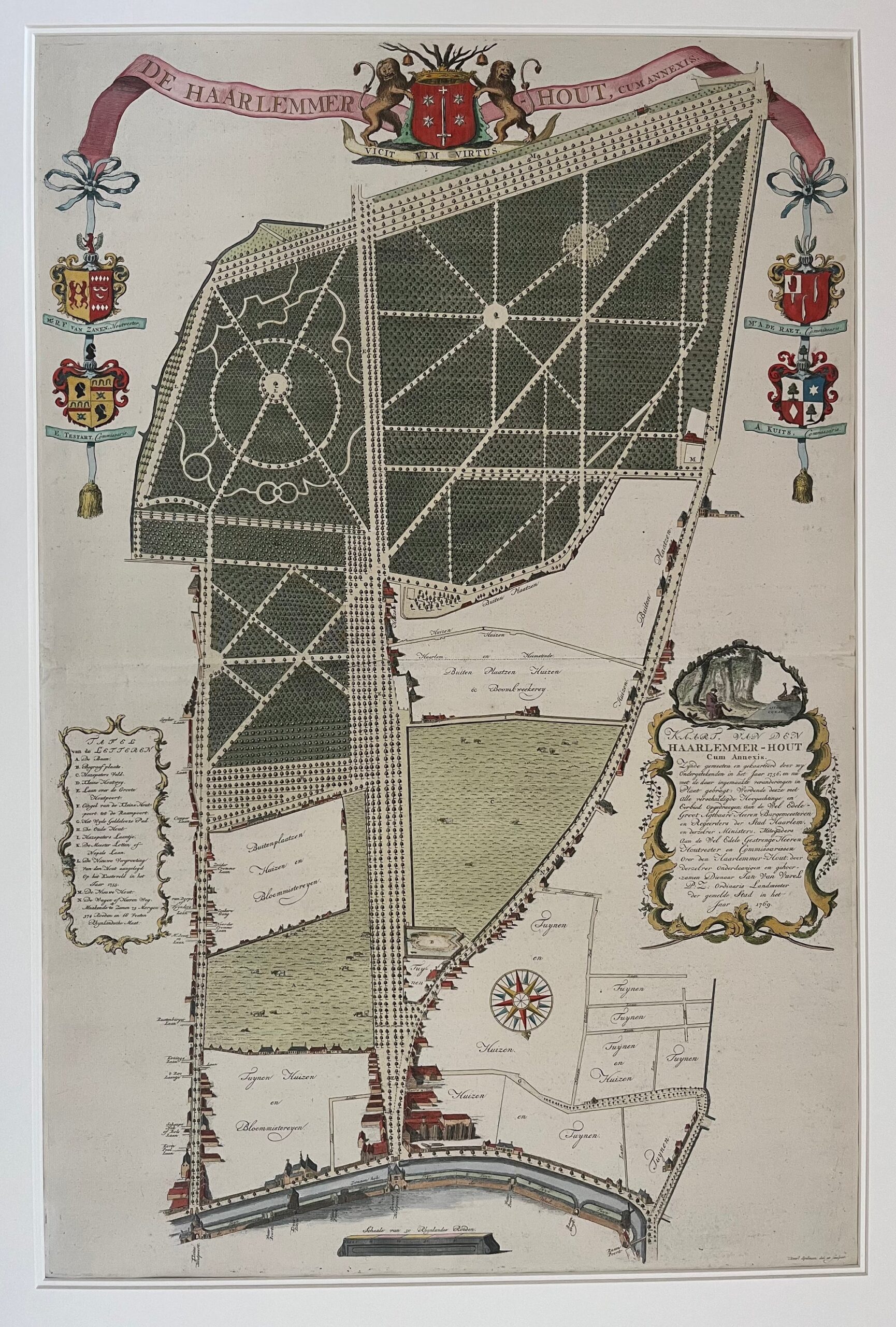
This Haarlem De Hout Map titled ‘Kaart van den Haarlemmer-Hout cum annexis…’ is an impressive large engraving by Hendrik Spilman after Jan van Varel. The map shows the park and its surroundings as surveyed in 1756 and later updated and published in 1769. It offers an accurate layout of Haarlem’s famous park, the Dreef, and nearby roads such as Wagenweg and Houtplein.
The detailed map measures 92 x 61 cm and remains in very good condition, with a visible fold as published and later hand colouring that enhances its visual appeal. This map includes the dedication to the city council and the commissioners of the Hout, whose coats of arms appear at the top.
Collectors value this Haarlem De Hout Map for its historical precision and decorative presentation. It offers both artistic beauty and a rich record of 18th‑century Haarlem’s landscape planning and civic pride.
About the Artist: Hendrik Spilman, Jan van Varel
Unfortunately, there is no information available about this artist yet. We will update this section when possible.
About the Era: 18th Century (1700s)
During the 18th century, mapmaking became more scientific and precise. Improved instruments like the telescope and chronometer helped cartographers increase accuracy, shifting maps from decorative art to factual documents. Copperplate engraving stayed as the main printing method, producing fine lines, while hand-coloring added visual impact. French cartographers, such as the Cassini family, led national surveys with geodetic measurements and triangulation, while Dutch mapmakers like Joan Blaeu enhanced printing and atlas quality, ushering in a golden age of atlases.
Maps began including more information and notes to help users, and ornate decorations mostly gave way to scientific clarity, except for cartouches and borders. National and colonial ambitions guided map production to aid navigation and territorial claims. By the late 18th century, large-scale surveys set modern cartography standards. Today, 18th-century maps mix scientific knowledge with artistry, are prized by collectors, and have influenced later cartographic methods. They offer insights into Enlightenment exploration and geography.