Full Description
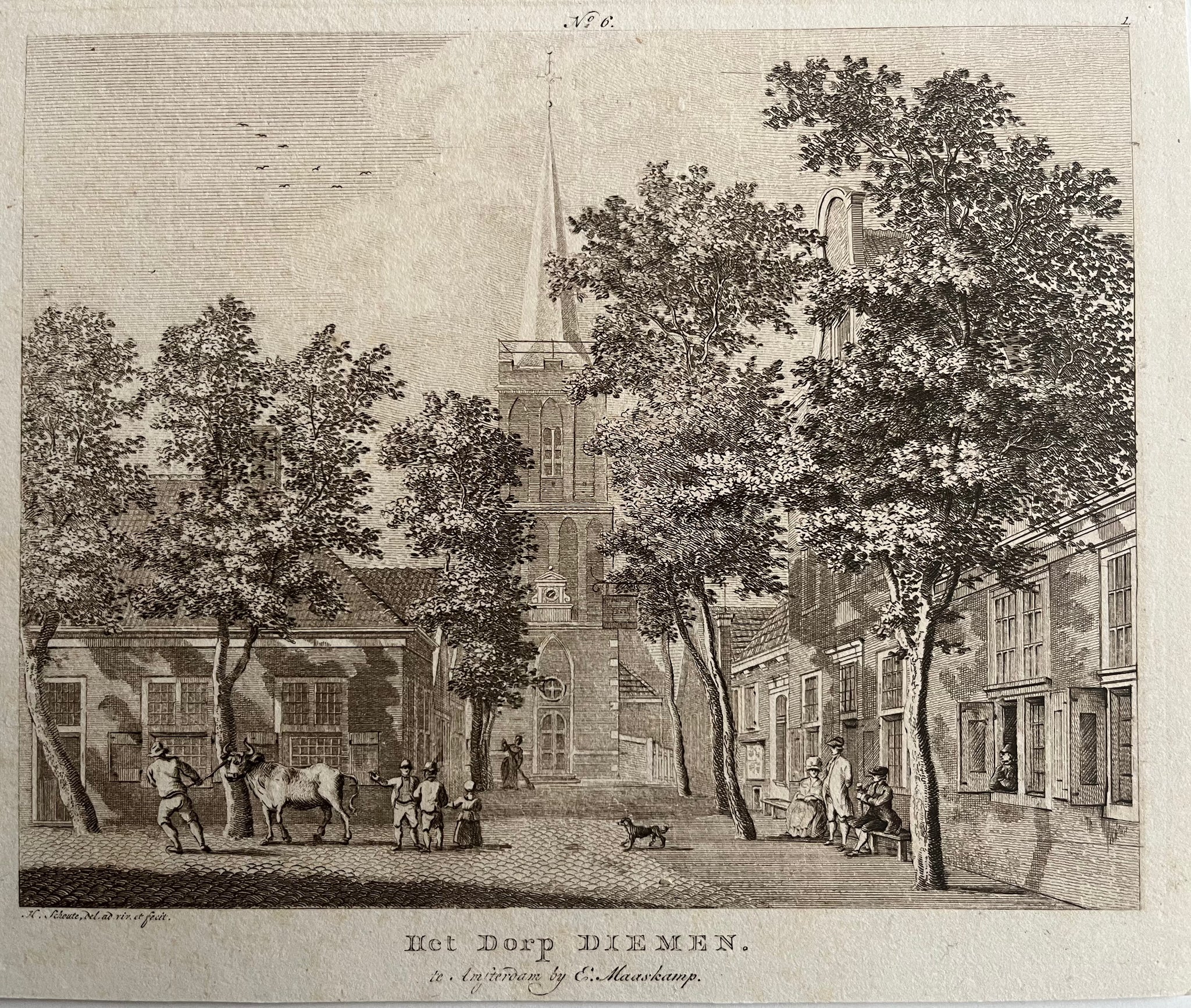
This Diemen Etching by Hermanus Schouten titled ‘Het Dorp Diemen’ gives a peaceful view of the historic village and its church. Hermanus Schouten created the etching around 1770, and Evert Maaskamp published it in Amsterdam. The composition captures the calm atmosphere of rural North Holland, showing houses, trees, and the church tower rising in the distance.
The etching measures about 15 x 19 cm and remains in very good condition. Schouten’s careful line work and balanced layout bring a clear sense of space and light to the scene. His style reflects the quiet charm of 18th‑century Dutch countryside views. This etching is both elegant and historically significant, preserving the look of a small Dutch village before industrial change.
Collectors of antique prints and Dutch topographical art value this Diemen Etching by Hermanus Schouten for its fine detail, authenticity, and timeless rural character.
About the Artist: Hermanus Schouten
Unfortunately, there is no information available about this artist yet. We will update this section when possible.
About the Era: 18th Century (1700s)
During the 18th century, mapmaking became more scientific and precise. Improved instruments like the telescope and chronometer helped cartographers increase accuracy, shifting maps from decorative art to factual documents. Copperplate engraving stayed as the main printing method, producing fine lines, while hand-coloring added visual impact. French cartographers, such as the Cassini family, led national surveys with geodetic measurements and triangulation, while Dutch mapmakers like Joan Blaeu enhanced printing and atlas quality, ushering in a golden age of atlases.
Maps began including more information and notes to help users, and ornate decorations mostly gave way to scientific clarity, except for cartouches and borders. National and colonial ambitions guided map production to aid navigation and territorial claims. By the late 18th century, large-scale surveys set modern cartography standards. Today, 18th-century maps mix scientific knowledge with artistry, are prized by collectors, and have influenced later cartographic methods. They offer insights into Enlightenment exploration and geography.