Full Description
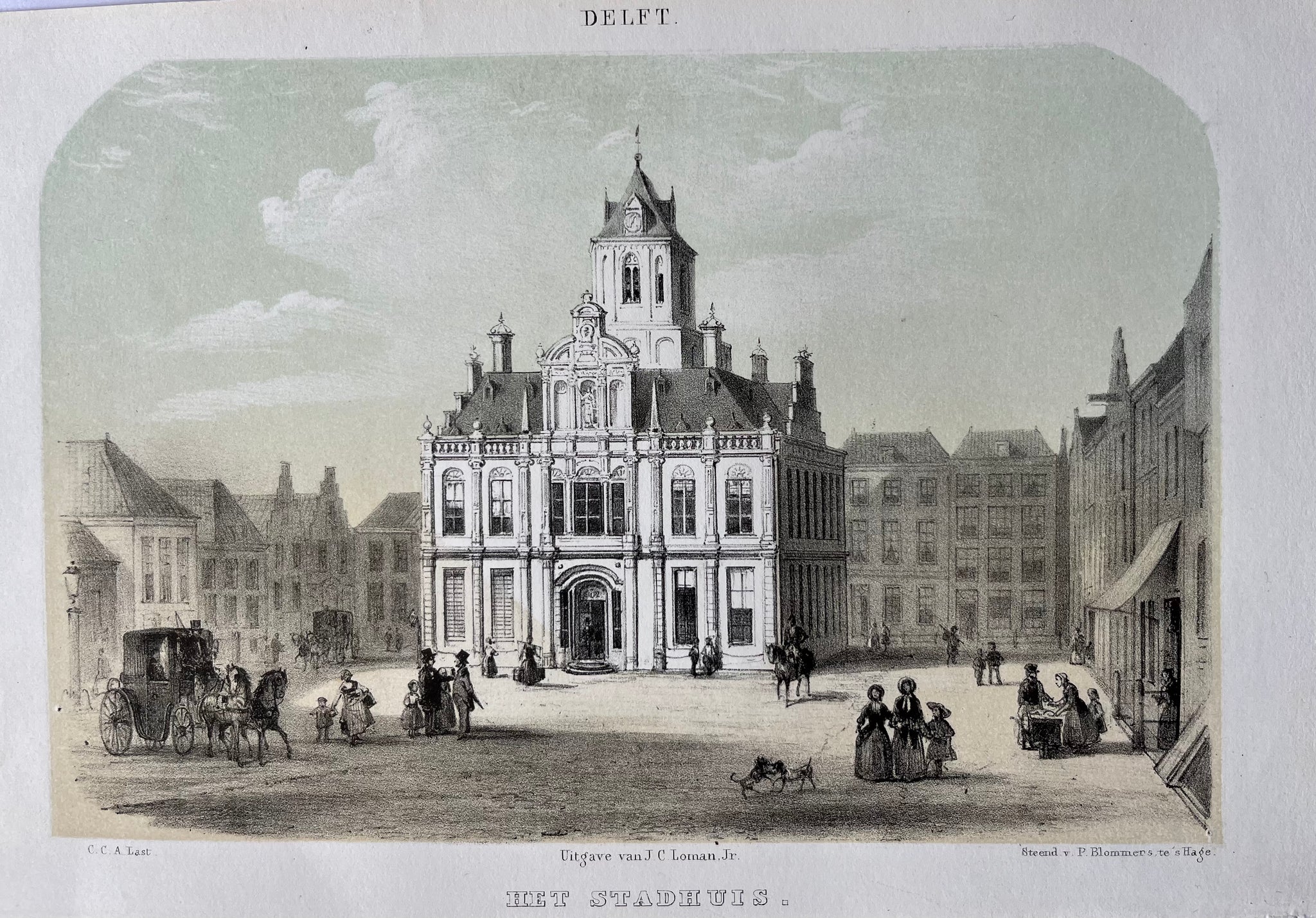
This Delft Townhall Lithograph titled ‘Delft – Het Stadhuis’ shows a refined mid‑19th‑century view of the Townhall on the Market Square. C. Last drew the scene, and P. Blommers lithographed it. J.C. Loman published the print in 1857.
The lithograph measures 21.5 x 14.5 cm and is tinted with soft, warm tones. The image captures the elegant architecture of the Townhall, framed by surrounding buildings and everyday figures on the Markt. Fine detailing and balanced composition give the scene depth and charm.
This Delft Townhall Lithograph is in very good condition. It makes a wonderful collector’s piece or a thoughtful gift for anyone connected with Delft or its university. The print reflects both architectural beauty and 19th‑century Dutch craftsmanship.
About the Artist: C. Last
Unfortunately, there is no information available about this artist yet. We will update this section when possible.
About the Era: 19th Century (1800s)
The 19th century marked the era of cartography, as mapmaking became professional, organized, and global. Scientists and surveyors used improved instruments and statistical methods, turning maps into trusted scientific documents with greater precision. Surveying advanced with triangulation, precise tools, and national topographic programs. Printing technology improved, adopting lithography and early color printing to produce clearer, richer maps. New thematic maps used techniques like choropleth, flow lines, and dot density to show data visually. Notably, Charles Minard pioneered multivariate mapping, combining multiple data themes on one map.
Map design reflected industrial and Victorian tastes, balancing detail and readability. Governments supported mapping societies to control territories at home and abroad. Maps became essential for urban planning, empire-building, and scientific research. The 19th century also fostered a global map culture, sharing knowledge internationally. Today, 19th-century maps are prized for their science and artistry. They laid the foundation for modern cartography, data visualization, and geographic information science, and are celebrated by collectors and institutions for their insight into industrial-age geography and culture.