Full Description
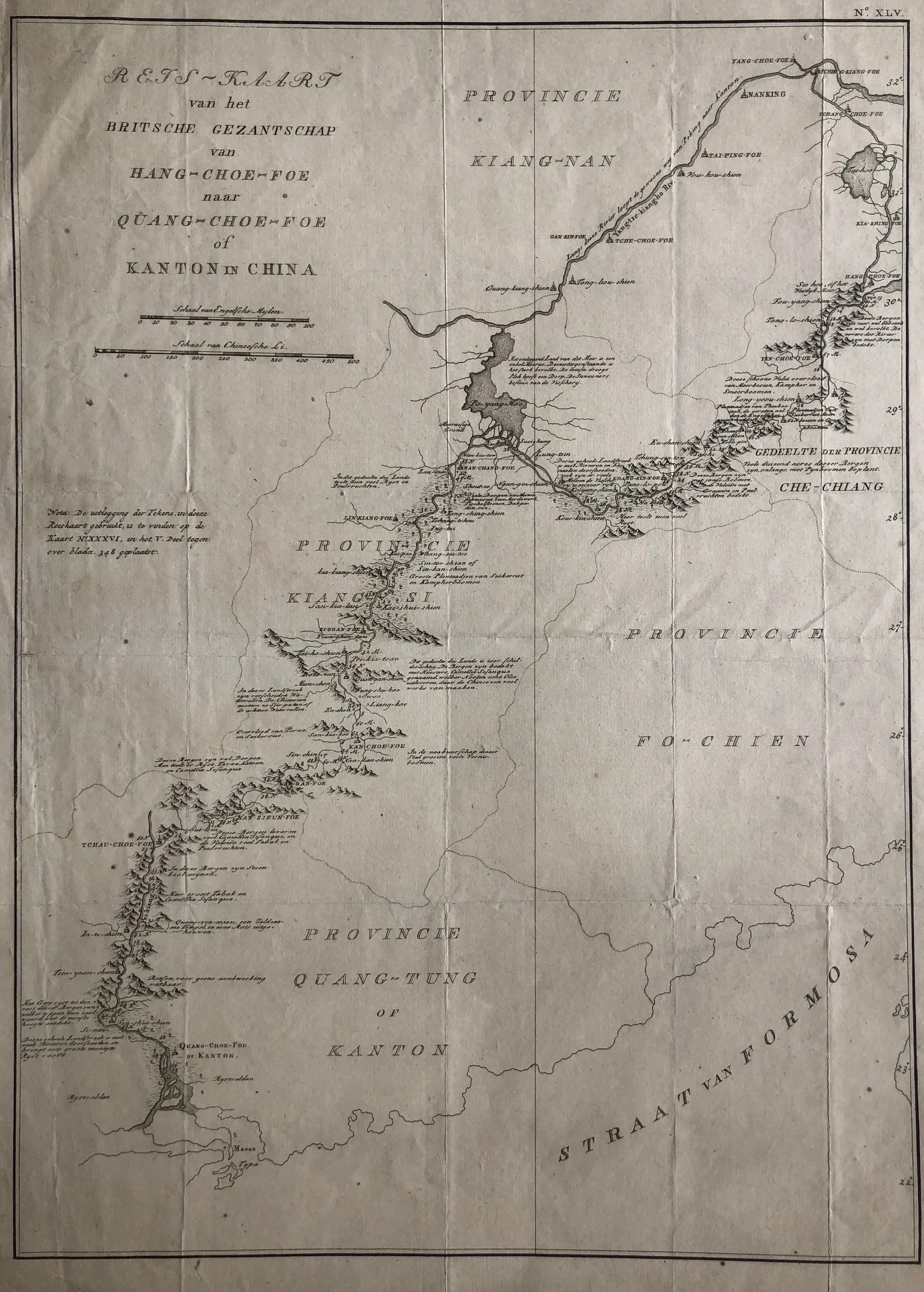
This very rare antique map is titled “Reis-kaart van het Britsche gezantschap van Hang-choe-foe naar Quang-choe-foe of Kanton in China.” The map shows the eastern coast of China and traces the route of the British legation during the late 18th century. It offers a unique view of early European travel and diplomacy in China.
The map dates from around 1800 and was engraved in the Netherlands. It focuses on coastal geography, rivers, and key cities along the journey from Hangzhou to Canton. As a result, it provides both geographic detail and historical context.
This Rare antique map of China measures 43 × 31 cm and is in good condition. Original folds remain visible, as published, and the edges show some wrinkling. Collectors value this antique map of China for its rarity, subject matter, and insight into early Sino-European relations.
About the Artist: Unknown
Unfortunately, there is no information available about this artist yet. We will update this section when possible.
About the Era: 18th Century (1700s)
During the 18th century, mapmaking became more scientific and precise. Improved instruments like the telescope and chronometer helped cartographers increase accuracy, shifting maps from decorative art to factual documents. Copperplate engraving stayed as the main printing method, producing fine lines, while hand-coloring added visual impact. French cartographers, such as the Cassini family, led national surveys with geodetic measurements and triangulation, while Dutch mapmakers like Joan Blaeu enhanced printing and atlas quality, ushering in a golden age of atlases.
Maps began including more information and notes to help users, and ornate decorations mostly gave way to scientific clarity, except for cartouches and borders. National and colonial ambitions guided map production to aid navigation and territorial claims. By the late 18th century, large-scale surveys set modern cartography standards. Today, 18th-century maps mix scientific knowledge with artistry, are prized by collectors, and have influenced later cartographic methods. They offer insights into Enlightenment exploration and geography.