Full Description
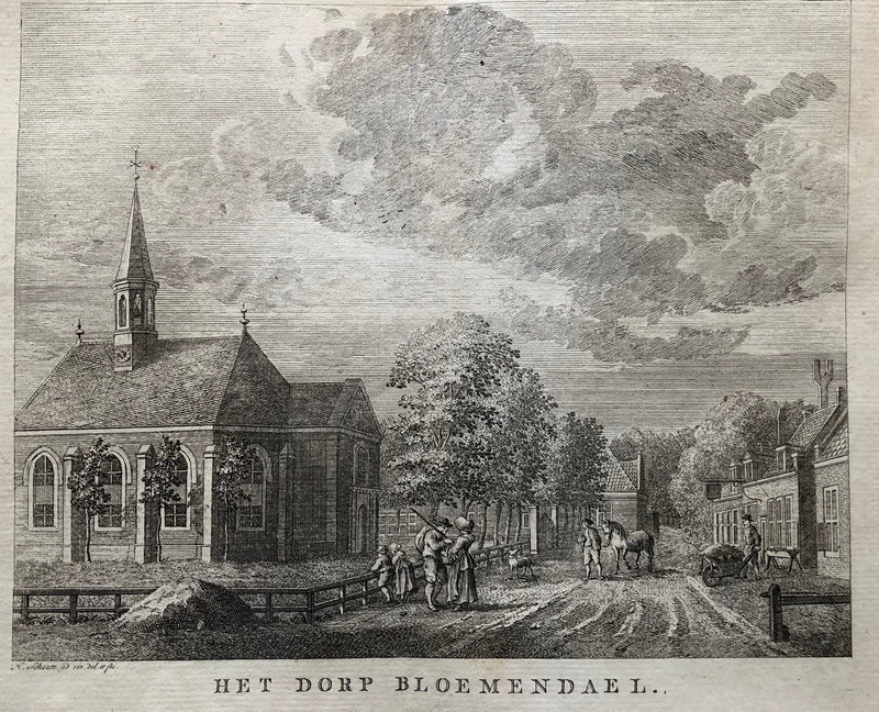
Het Dorp Bloemendael is a rare and desirable engraving by Hermanus Schouten, published around 1760. The print shows the church of Bloemendaal with the Kerkplein and Bloemendaalseweg in the foreground. Schouten captures the calm charm of this Noord Holland village with precise architectural lines and atmospheric detail. His engraving style gives the scene depth and a strong sense of place.
This Bloemendaal village engraving measures 15 x 19 cm and is in very good condition, with a visible fold in the centre as published. The impression remains crisp and clear throughout. Collectors prize this Bloemendaal village engraving for its rarity, historical value, and refined depiction of an 18th‑century Dutch village. VAT: Margingoods.
Explore our entire collection of City Views, antique maps, Botanical prints and much more at our store located in the historic heart of Haarlem.
About the Artist: Hermanus Schouten
Unfortunately, there is no information available about this artist yet. We will update this section when possible.
About the Era: 18th Century (1700s)
During the 18th century, mapmaking became more scientific and precise. Improved instruments like the telescope and chronometer helped cartographers increase accuracy, shifting maps from decorative art to factual documents. Copperplate engraving stayed as the main printing method, producing fine lines, while hand-coloring added visual impact. French cartographers, such as the Cassini family, led national surveys with geodetic measurements and triangulation, while Dutch mapmakers like Joan Blaeu enhanced printing and atlas quality, ushering in a golden age of atlases.
Maps began including more information and notes to help users, and ornate decorations mostly gave way to scientific clarity, except for cartouches and borders. National and colonial ambitions guided map production to aid navigation and territorial claims. By the late 18th century, large-scale surveys set modern cartography standards. Today, 18th-century maps mix scientific knowledge with artistry, are prized by collectors, and have influenced later cartographic methods. They offer insights into Enlightenment exploration and geography.