Full Description
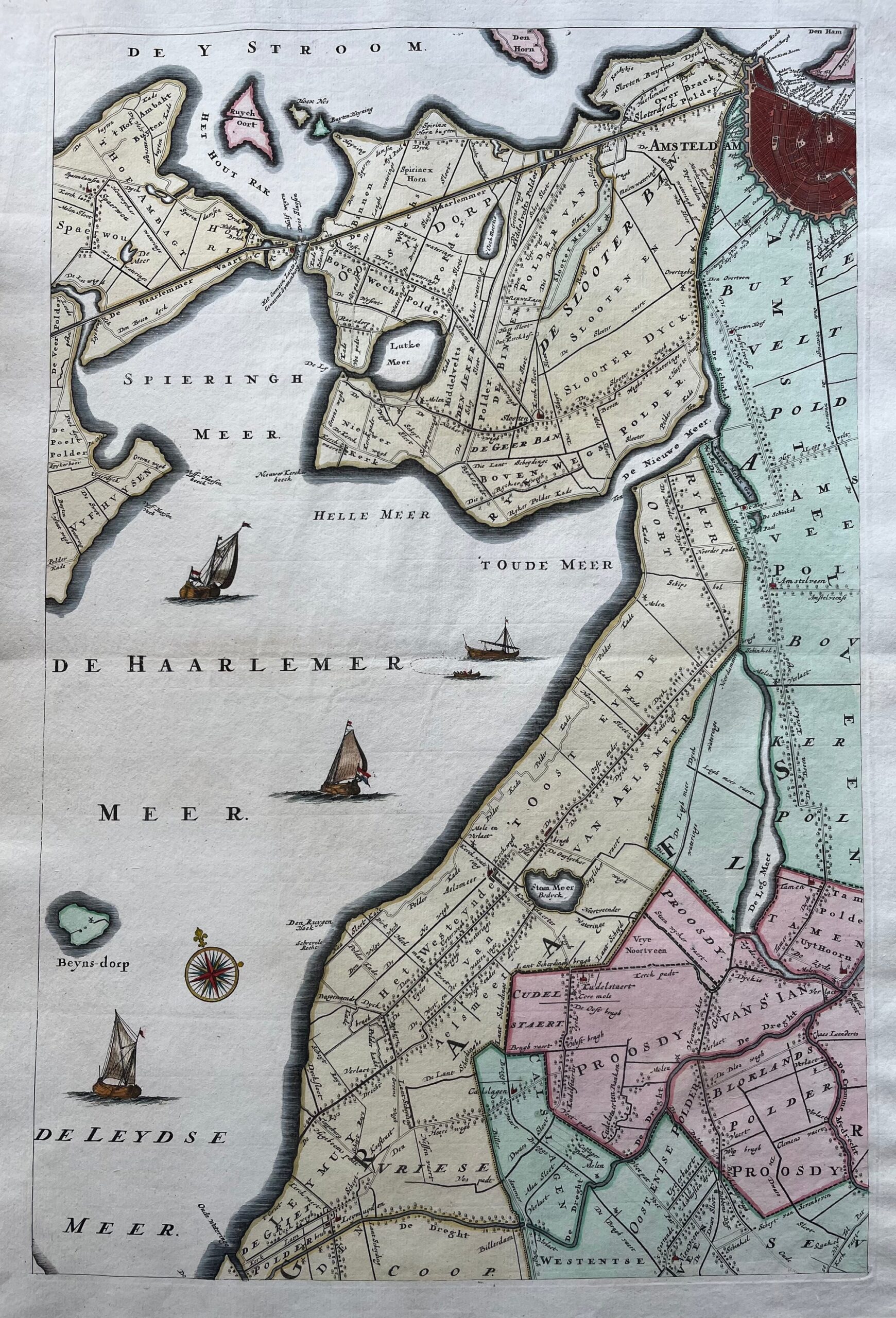
This Antique Amsterdam Area Map presents a finely detailed 18th‑century view of the region, including Haarlemmermeer, Halfweg, Ystroom, and Aalsmeer. It forms the first section of the famous wall map of the Province of Utrecht by Van Doesburgh and De Roy, published by Covens and Mortier in 1743. The engraving reveals waterways, towns, and farmlands that shaped the surrounding landscape of early modern Amsterdam.
The map measures 55 x 36.5 cm and remains in very good condition, coloured by a later hand. The precise engraving and rich colouring highlight both artistic skill and geographic accuracy. The Amsterdam Area Map by Covens and Mortier illustrates the cartographic excellence for which this Amsterdam publishing house was known.
Collectors of antique maps and Dutch topographical works value this Amsterdam Area Map by Covens and Mortier for its scale, decorative colouring, and historical insight into the mid‑18th‑century Dutch landscape.
About the Artist: de Roy, van Doesburgh
Unfortunately, there is no information available about this artist yet. We will update this section when possible.
About the Era: 18th Century (1700s)
During the 18th century, mapmaking became more scientific and precise. Improved instruments like the telescope and chronometer helped cartographers increase accuracy, shifting maps from decorative art to factual documents. Copperplate engraving stayed as the main printing method, producing fine lines, while hand-coloring added visual impact. French cartographers, such as the Cassini family, led national surveys with geodetic measurements and triangulation, while Dutch mapmakers like Joan Blaeu enhanced printing and atlas quality, ushering in a golden age of atlases.
Maps began including more information and notes to help users, and ornate decorations mostly gave way to scientific clarity, except for cartouches and borders. National and colonial ambitions guided map production to aid navigation and territorial claims. By the late 18th century, large-scale surveys set modern cartography standards. Today, 18th-century maps mix scientific knowledge with artistry, are prized by collectors, and have influenced later cartographic methods. They offer insights into Enlightenment exploration and geography.