Full Description
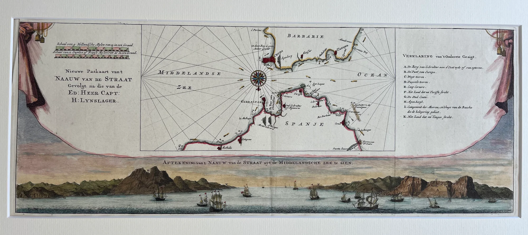
This finely detailed, hand-colored Antique Gibraltar sea chart shows the Strait of Gibraltar, the key maritime gateway between the Atlantic Ocean and the Mediterranean Sea. Johannes Ratelband published it in Amsterdam around 1720. The chart is based on the navigational observations of Captain H. Lynslager. It features coastal place names along Spain, Gibraltar, and North Africa (Barbarie). The nautical chart includes rhumb lines and a decorative compass rose to aid navigation. Shorelines and maritime details stand out clearly. The lower section shows a panoramic coastal elevation with sailing vessels. Numbered landmarks correspond to a legend (Verklaring) for easy identification.
This antique copperplate engraving of the Strait of Gibraltar sea chart measures 17.5 by 46 cm and is in excellent condition. It has a clean impression, fine original colors, and a light centerfold as issued. This chart combines Dutch maritime mapmaking accuracy with artistic elegance. It highlights the Dutch Republic’s navigational skills and its strategic and commercial interests in controlling Mediterranean access. Collectors and maritime history enthusiasts will find this an exceptional example of early 18th-century Dutch cartography and craftsmanship.
About the Artist: Johannes Ratelband
Johannes Ratelband (1715–1793) was a Dutch map publisher and cartographer based in Amsterdam during the 18th century. Though relatively obscure compared to some of his contemporaries, Ratelband produced a variety of maps and atlases that contributed to cartographic knowledge at the time. His works include detailed regional maps such as those of South America and Europe, often characterized by their accuracy and artistic engraving quality. Ratelband’s maps are valued for their historical geographic content and their role in the Dutch tradition of map publishing during the Enlightenment period.
About the Era: 18th Century (1700s)
During the 18th century, mapmaking became more scientific and precise. Improved instruments like the telescope and chronometer helped cartographers increase accuracy, shifting maps from decorative art to factual documents. Copperplate engraving stayed as the main printing method, producing fine lines, while hand-coloring added visual impact. French cartographers, such as the Cassini family, led national surveys with geodetic measurements and triangulation, while Dutch mapmakers like Joan Blaeu enhanced printing and atlas quality, ushering in a golden age of atlases.
Maps began including more information and notes to help users, and ornate decorations mostly gave way to scientific clarity, except for cartouches and borders. National and colonial ambitions guided map production to aid navigation and territorial claims. By the late 18th century, large-scale surveys set modern cartography standards. Today, 18th-century maps mix scientific knowledge with artistry, are prized by collectors, and have influenced later cartographic methods. They offer insights into Enlightenment exploration and geography.