Full Description
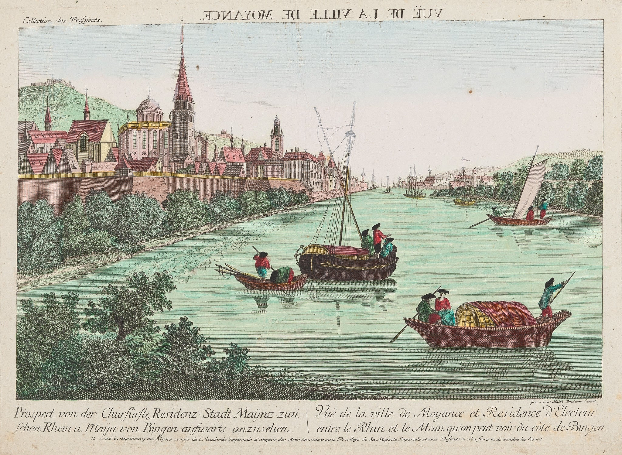
This Mainz Optical Print by Leizel is a prospect von der Churfürstl. Residenz-Stadt Maynz zwischen Rhein und Mayn von Bingen aufwärts anzusehen is a beautiful handcoloured optical print published around 1770 by Leizel in Augsburg. The engraving presents a panoramic view of Mainz, showing the city as seen between the rivers Rhine and Main. The lively scene features towers, bridges, and ships highlighted with fresh, strong colours that bring the composition to life.
This Mainz optical print measures 24.7 x 38.7 cm and remains in very good condition. The colouring is vivid, and only minor folds are present. Designed for use with a zograscope, the perspective creates a remarkable sense of depth. Collectors prize this print for its historical value, bright tones, and detailed depiction of 18th-century Mainz. VAT: Margingoods, no VAT.
About the Artist: Leizel
Unfortunately, there is no information available about this artist yet. We will update this section when possible.
About the Era: 18th Century (1700s)
During the 18th century, mapmaking became more scientific and precise. Improved instruments like the telescope and chronometer helped cartographers increase accuracy, shifting maps from decorative art to factual documents. Copperplate engraving stayed as the main printing method, producing fine lines, while hand-coloring added visual impact. French cartographers, such as the Cassini family, led national surveys with geodetic measurements and triangulation, while Dutch mapmakers like Joan Blaeu enhanced printing and atlas quality, ushering in a golden age of atlases.
Maps began including more information and notes to help users, and ornate decorations mostly gave way to scientific clarity, except for cartouches and borders. National and colonial ambitions guided map production to aid navigation and territorial claims. By the late 18th century, large-scale surveys set modern cartography standards. Today, 18th-century maps mix scientific knowledge with artistry, are prized by collectors, and have influenced later cartographic methods. They offer insights into Enlightenment exploration and geography.