Full Description
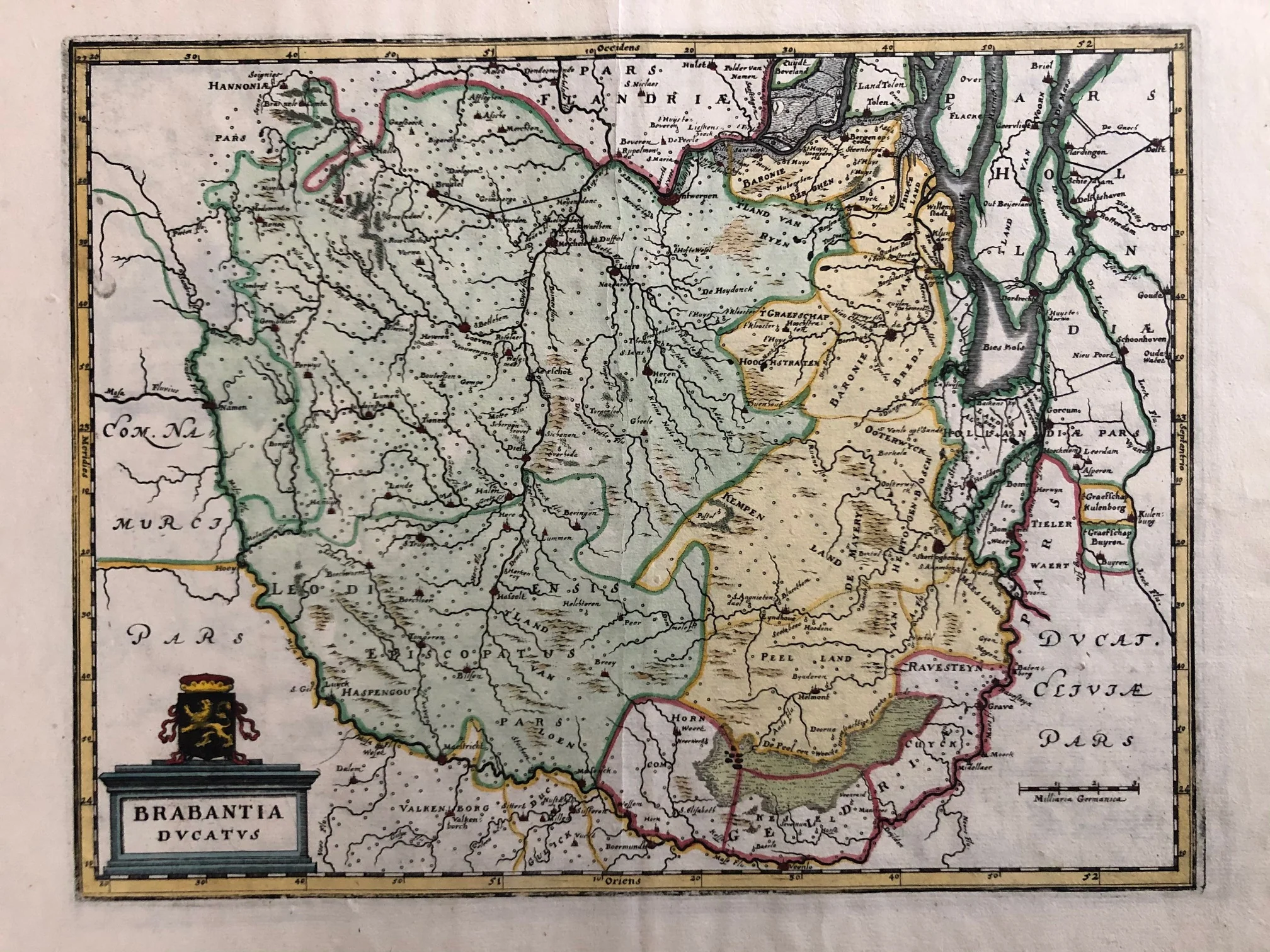
This Brabant Ducatus Map Merian titled ‘Brabantia Ducatus’ is a beautiful 17th‑century engraving published by Caspar Merian in 1659. It appeared in his well‑known atlas Topographia Germaniae Inferioris. The handcoloured map presents the Duchy of Brabant with detailed towns, rivers, and borders, including places such as Breda, Helmond, and Antwerp. Elegant cartouches and clear engraving lines make it both decorative and historically valuable.
The map measures 25 x 33 cm and is in very good condition, with a visible fold as published. The colours are clean and fresh, showing careful hand finishing. Merian’s precise engraving brings out the geography and charm of this important region in early modern Europe.
This Brabant Ducatus Map Merian is a fine example of 17th‑century cartography. It appeals to collectors of antique maps and those with an interest in the historical landscapes of the Low Countries.
About the Artist: Merian
Unfortunately, there is no information available about this artist yet. We will update this section when possible.
About the Era: 17th Century (1600s)
The 17th century greatly advanced mapmaking and printmaking, with copperplate engraving enabling cartographers to create detailed and accurate maps. During the Dutch Golden Age, increased trade and exploration boosted the demand for maps, turning map printing into a major industry. Skilled engravers carved designs into copper plates, applied ink, and pressed paper to produce fine prints. After printing, artisans hand-colored maps to enhance their beauty and clarity. Copperplate printing replaced woodcuts, offering smoother lines and finer details. Renowned mapmakers like Blaeu, Janssonius, and Hondius combined scientific knowledge with artistic skill. This era produced remarkable atlases, such as Joan Blaeu’s Atlas Maior. Maps not only charted geography but reflected political power, trade routes, and scientific discoveries. Printed maps became essential for navigation, colonization, and education. Dutch publishers led Europe’s map market, shaping global cartographic standards. These original maps remain prized for their detail and artistry, influencing future mapmaking and holding high value for collectors and museums today.