Full Description
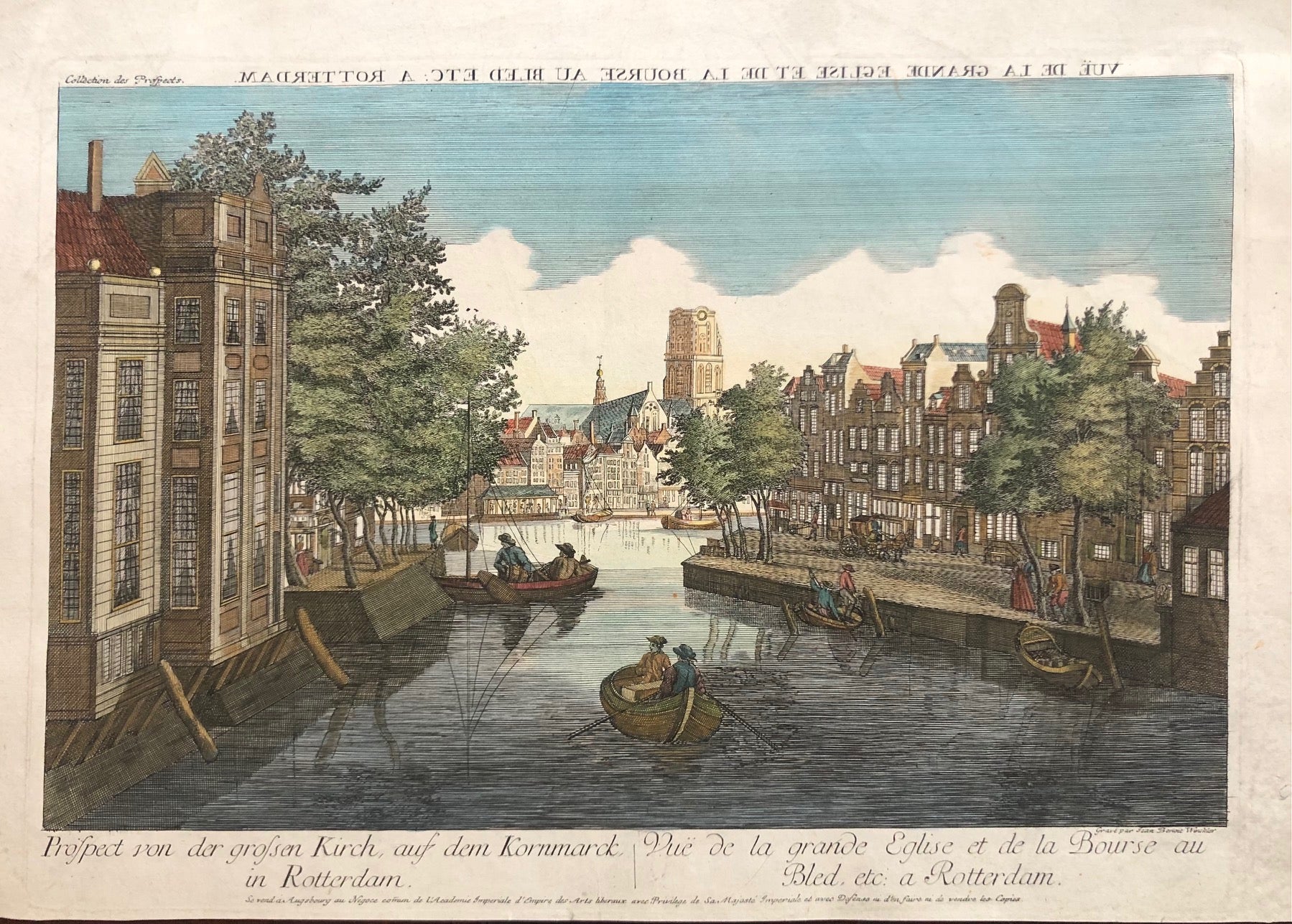
This Rotterdam Grote Kerk Engraving titled ‘Vue de la Grande Eglise et de la Bourse au Bled etc. à Rotterdam’ offers a lively 18th‑century city view. Jean Benoit Winckler engraved and published this handcoloured optical print in Augsburg around 1760. It shows the Grote Kerk (Laurenskerk) and the busy Korenmarkt, two central landmarks of Rotterdam.
The print measures 36 x 46.3 cm and remains in very good condition, with later hand colouring. The perspective style, created for use with a zograscope, gives depth and dimension to the scene. Figures, canal activity, and the church’s distinct tower bring the Rotterdam of the 18th century to life.
This Rotterdam Grote Kerk Engraving is ideal for collectors of Dutch city views and optical prints. It captures the energy and charm of a thriving river port through detailed craftsmanship and vivid perspective.
About the Artist: Jean Benoit Winckler
Unfortunately, there is no information available about this artist yet. We will update this section when possible.
About the Era: 18th Century (1700s)
During the 18th century, mapmaking became more scientific and precise. Improved instruments like the telescope and chronometer helped cartographers increase accuracy, shifting maps from decorative art to factual documents. Copperplate engraving stayed as the main printing method, producing fine lines, while hand-coloring added visual impact. French cartographers, such as the Cassini family, led national surveys with geodetic measurements and triangulation, while Dutch mapmakers like Joan Blaeu enhanced printing and atlas quality, ushering in a golden age of atlases.
Maps began including more information and notes to help users, and ornate decorations mostly gave way to scientific clarity, except for cartouches and borders. National and colonial ambitions guided map production to aid navigation and territorial claims. By the late 18th century, large-scale surveys set modern cartography standards. Today, 18th-century maps mix scientific knowledge with artistry, are prized by collectors, and have influenced later cartographic methods. They offer insights into Enlightenment exploration and geography.