Full Description
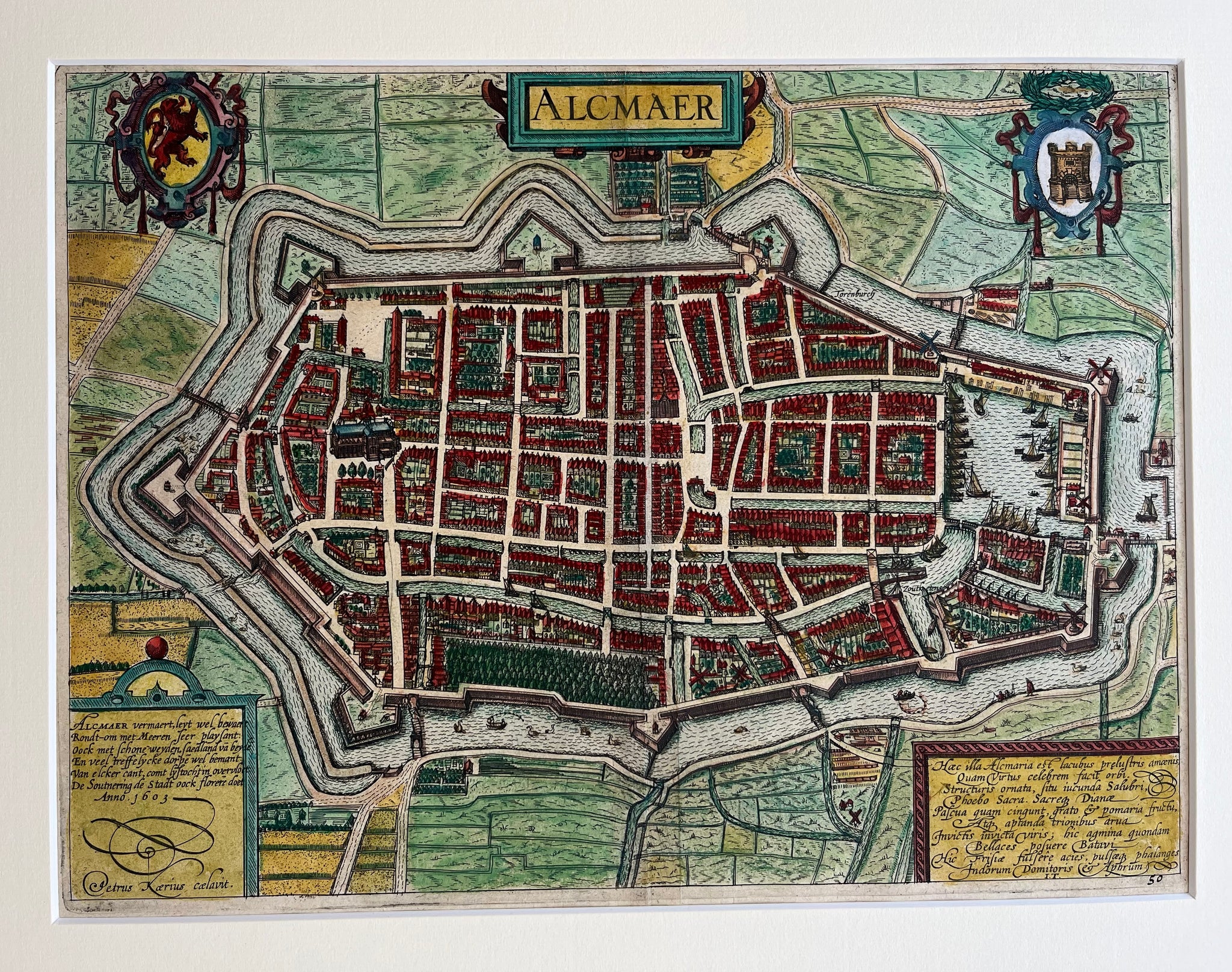
This Alkmaar City Map Kaerius titled ‘Alcmaer’ is a superb early 17th‑century handcoloured engraving. Petrus Kaerius designed it in 1603, and Guicciardini published it in 1610. The map presents a detailed and lively view of Alkmaar with streets, canals, and city walls clearly drawn. Decorative cartouches, a compass rose, and fine lettering give the composition charm and character.
The engraving measures 24.5 x 33 cm and remains in very good condition. The colours are bright, and the impression is strong. Clean lines and smooth paper reveal careful preservation. Each element reflects the precision and elegance typical of the Dutch Golden Age of mapmaking.
This Alkmaar City Map Kaerius is ideal for collectors of antique maps or enthusiasts of Dutch history. It captures Alkmaar as a proud fortified city and celebrates the craftsmanship of Petrus Kaerius, one of the most respected engravers of his time.
About the Artist: Petrus Kaerius
Unfortunately, there is no information available about this artist yet. We will update this section when possible.
About the Era: 17th Century (1600s)
The 17th century greatly advanced mapmaking and printmaking, with copperplate engraving enabling cartographers to create detailed and accurate maps. During the Dutch Golden Age, increased trade and exploration boosted the demand for maps, turning map printing into a major industry. Skilled engravers carved designs into copper plates, applied ink, and pressed paper to produce fine prints. After printing, artisans hand-colored maps to enhance their beauty and clarity. Copperplate printing replaced woodcuts, offering smoother lines and finer details. Renowned mapmakers like Blaeu, Janssonius, and Hondius combined scientific knowledge with artistic skill. This era produced remarkable atlases, such as Joan Blaeu’s Atlas Maior. Maps not only charted geography but reflected political power, trade routes, and scientific discoveries. Printed maps became essential for navigation, colonization, and education. Dutch publishers led Europe’s map market, shaping global cartographic standards. These original maps remain prized for their detail and artistry, influencing future mapmaking and holding high value for collectors and museums today.