Worldmap by Visscher 1664
€1,400.00
– Sold Out| /
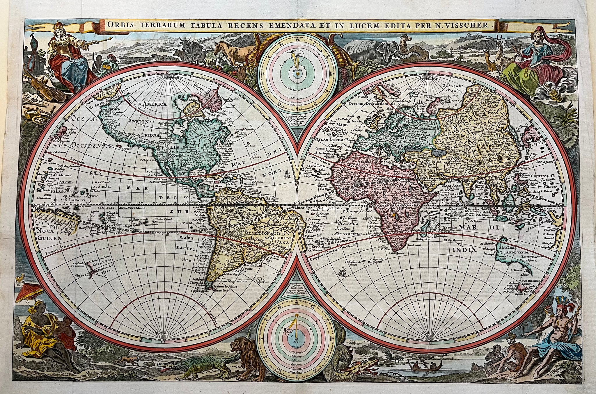
Title: ‘ Orbis Terrarum Tabula Recens Emendata Et In Lucem Edita Per N. Visscher’ . By Nicolaas J. Visscher from 1663. Handcoloured world map in 2 hemispheres, with two small polar hemispheres (upper and lower centre) depicting the solar system. The upper circle with the sun as centre (Copernicus), the lower circle with the earth as centre (Ptolemy). The corners of the map with 4 allegorical figures depicting the continents. The east of Brazil is on the western hemisphere, California is depicted as an island and of Australia just a part of it is drawn.
Size: 30 x47 cm
Technique: Engraving , coloured with later hand
Condition: Very good, with wide margins. Verso : Dutch text ‘ Korte Beschryvinge van de Landtschappen des Werelts….’ .Visible folds as published
Published in bible by P.A. Van Ravesteyn, 1664
Litt. : Shirley 431. Poortman/Augusteijn 118
VAT: Margingoods
Search for: map, world, worldmap, antique map, old map, oude kaart, wereldkaart, antiek, gravure, visscher, ravesteyn, bible, bijbel, california, america, australia, asia, africa, brazil,