Asia
€2,750.00
| /
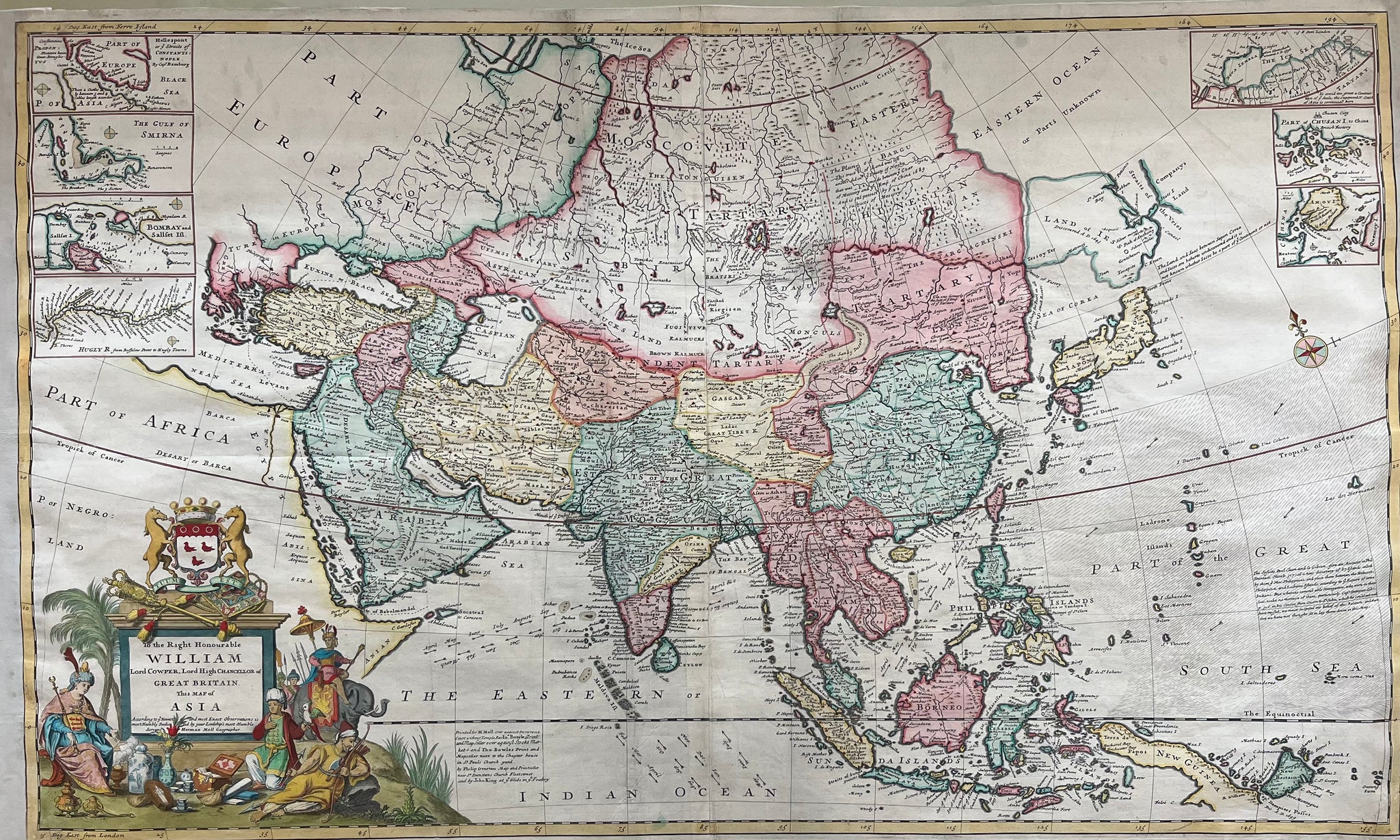
Title: ‘ To the Right Honourable William Lord Cowper, Lord High Chancellor of Great Britain, this Map of Asia.
London: H. Moll, D. Midwinter, Thos. Bowles, Philip Overton, (ca. 1720). A fine example of Moll’s intriguing map of Asia, depicting the continent just before the greatest era of European imperial expansion.
Large impressive map of Asia, engraved on two joined sheets, hand coloured, elaborate cartouche surmounted by the arms of the dedicatee: William, the first Earl Cowper, 7 vignette maps of Hellespont, the Gulf of Smirna, Bombay and Sallset Islands, Hugly River, an area north of the Arctic Circle including Nova Zembla and two maps of small parts of the Chinese coast including Chusan Island and Amaoy Island.
Ref.: Shirley, Maps in the Atlasses of the British Library I, T.Moll-4b,4; Cf. Reinhartz, The Cartographer and the Literati: Herman Moll and his Intellectual Circle.
Size: 59 x 97 cm (plate)
Condition: Very good (strengthened) on sides and middle verso.
VAT: Margingoods
Search for: map, old map, asia, antique map, india, bombay, nova zembla, moll, herman moll, William, borneo, sunda islands, ceylon, guinea, japan, formosa, arabia, indian ocean, engraving,